Back to Directory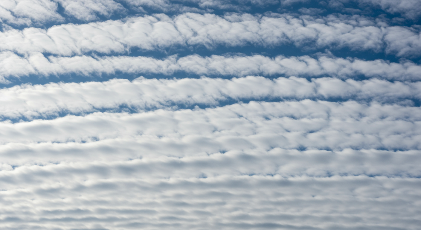
Altocumulus
Mid-level clouds appearing as white or greyish patches or sheets.
Altocumulus clouds are mid-level clouds that appear as white or greyish layers or patches with a waved or rounded appearance. They are composed of water droplets or ice crystals and can signal upcoming weather changes.
Formation
Formed by the lifting of an air mass, often associated with fronts, or by convection within an unstable mid-level layer.
Altitude
Middle (6,500 - 20,000 feet / 2,000 - 6,000 meters)
Precipitation
Usually none, but can produce light showers (virga) that evaporate before reaching the ground.
Visual Characteristics
- White or greyish patches, sheets, or layers.
- Often have a waved or mottled appearance.
- Composed of water droplets, sometimes ice crystals.
- Individual elements are larger and darker than cirrocumulus.
- Can create 'corona' effects around the sun or moon.
Discover Clouds with Our App!
Identify clouds on the go with our AI-powered Cloud Identifier iOS app.
Take your cloud knowledge to the next level. Our intuitive app helps you identify cloud types using your phone's camera. Perfect for weather enthusiasts, students, and curious minds!
Download on the App Store